ND Mapping Application
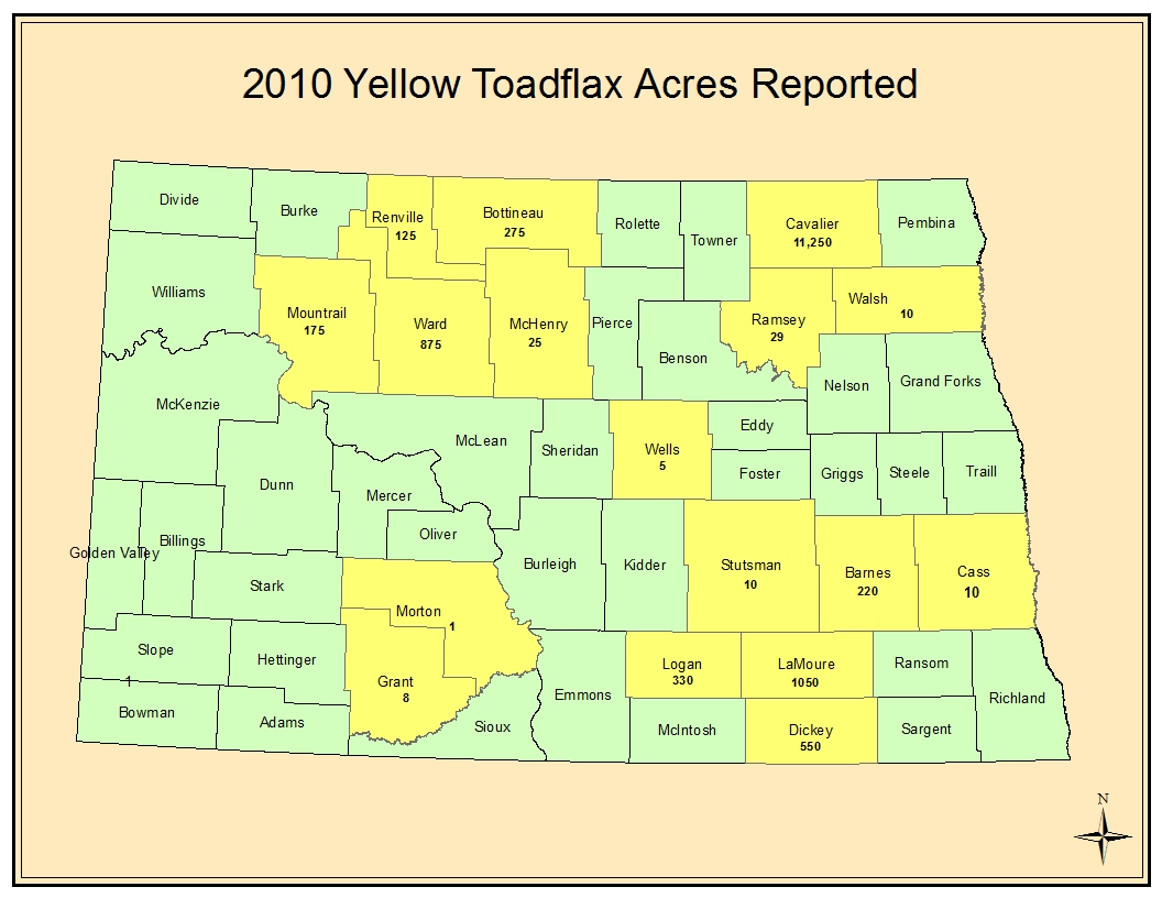
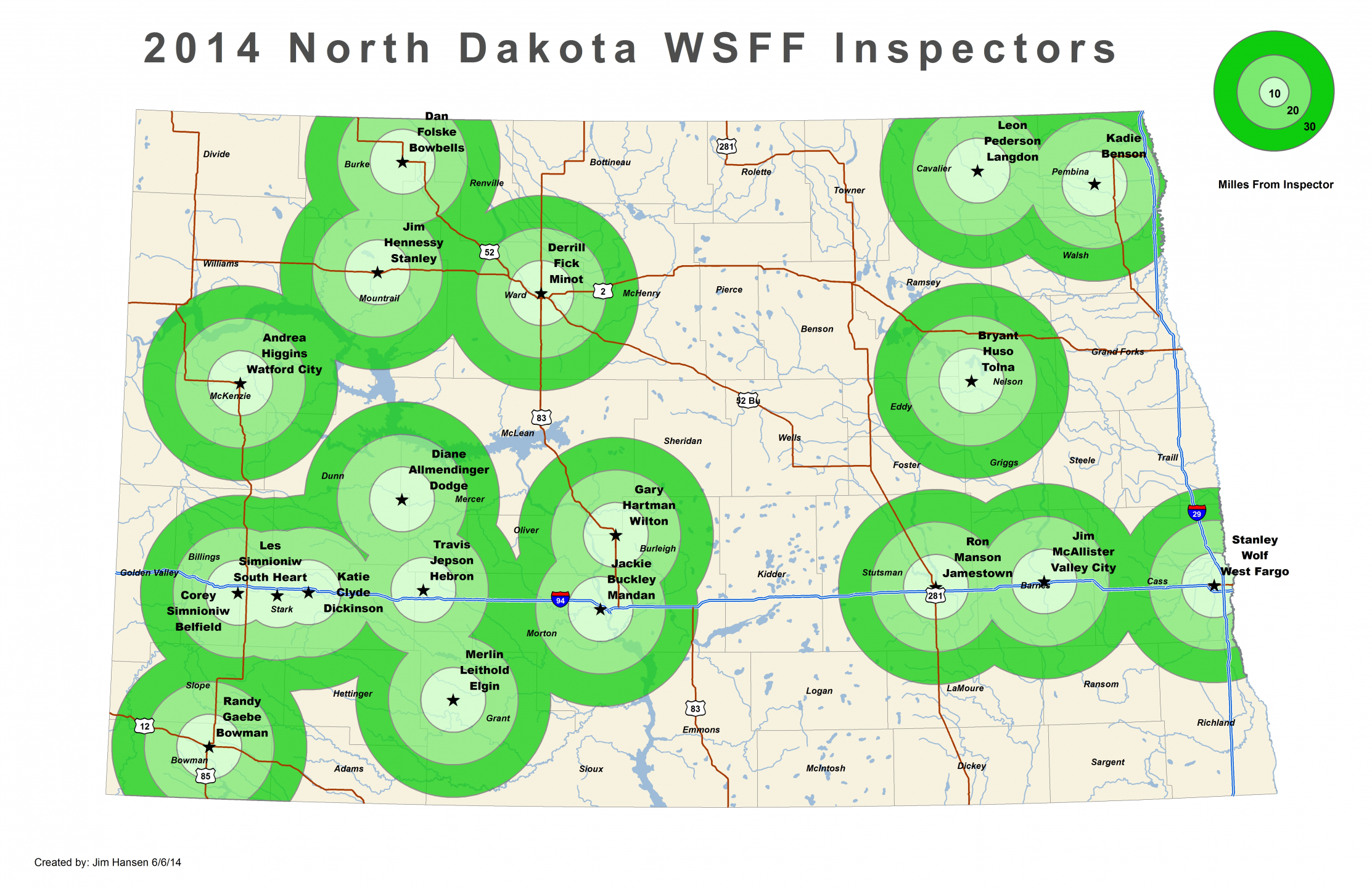
The ND Mapping Application allows you to track and view weeds over time to successfully see progress of weed control over several years. Also, you are now able to view Apiary, Organic farms, Vineyards and Winery locations in North Dakota. Users visiting the website can create and print their own maps by selecting the Key features and Weed inventory layers they would like to view.
Related Resources
GIS Maps Contacts